
Danube Road Trip: Belgrade to the Iron Gates (3 Days)
A 3-day self-drive down the Serbian Danube: Smederevo, Roman Viminacium, Silver Lake, Golubac, Lepenski Vir, the Kazan narrows and Kladovo.
Three days is what the Serbian Danube actually needs. The sights run for 300 km east of Belgrade: the flat-ground fortress at Smederevo, the Roman capital of Viminacium, the beaches of Silver Lake, the castle at Golubac, an 8,000-year-old fishing village at Lepenski Vir and the Kazan narrows where the river squeezes between two mountain ranges. Do it as a day trip and you’ll see Golubac and a lot of tarmac. Do it in three, with nights at Silver Lake and Kladovo, and the whole thing unspools at the pace it deserves.
The catch is the road. East of Golubac the two-lane state road hugs the cliffs through tunnels and blind curves - a beautiful, slow drive with no motorway shortcut back - so you plan in hours rather than kilometres, spending the first day on the easy stretch and saving the gorge for when you’ve time to pull over. You also need your own car: buses reach Golubac and Kladovo, but everything in between - the viewpoint track, the riverside museum, the fortresses out of town - sits where no timetable stops. Our guide to car rental in Serbia covers deposits and the motorway tolls south.
Day 1: Belgrade to Silver Lake, via a fortress and a Roman city
Leave early enough to be at Smederevo Fortress by mid-morning. The fortress sits where the Jezava meets the Danube, 50 km east of Belgrade, and its scale is startling from the car park: 11.3 hectares behind about 1.5 km of wall, with roughly 25 towers about 25 metres tall. Despot Djuradj Brankovic built it between 1427 and 1430 as a new Serbian capital after he was forced to hand Belgrade back to Hungary.
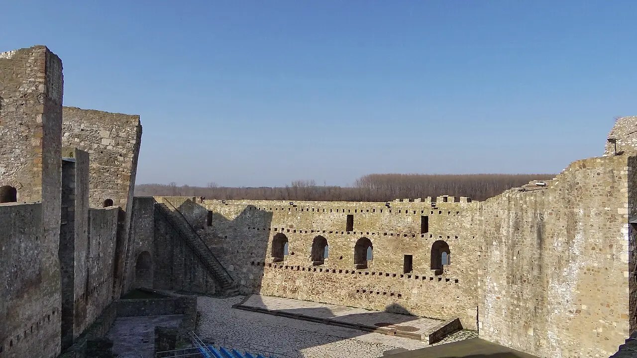
The gap-toothed look isn’t romantic decay. On 5 June 1941 German ammunition stored inside the walls went up, killing around 2,500 people and flattening much of the town along with the southern wall. Restoration has run in fits and starts since 1970, and the site has sat on the UNESCO tentative list since 2010. The outer grounds are open and free; the inner court, Mali grad, is ticketed at about 250 RSD for adults (150 concession, under-7s free), open daily roughly 08:00 to 20:00 in season and shorter hours off it. Carry a little cash for the gate.
Half an hour further east, past Pozarevac, a side road runs to Viminacium, the stop people underestimate. It was the capital of Moesia Superior from 87 AD and the base of the Seventh Claudian legion, a city of perhaps 40,000 over 450 hectares - most of it still unexcavated in the fields beside a working lignite mine. You see the greatest hits: the imperial mausoleum thought to belong to Emperor Hostilian, the thermae, and an amphitheatre that held 12,000 spectators, its timber grandstand rebuilt over the original arena.
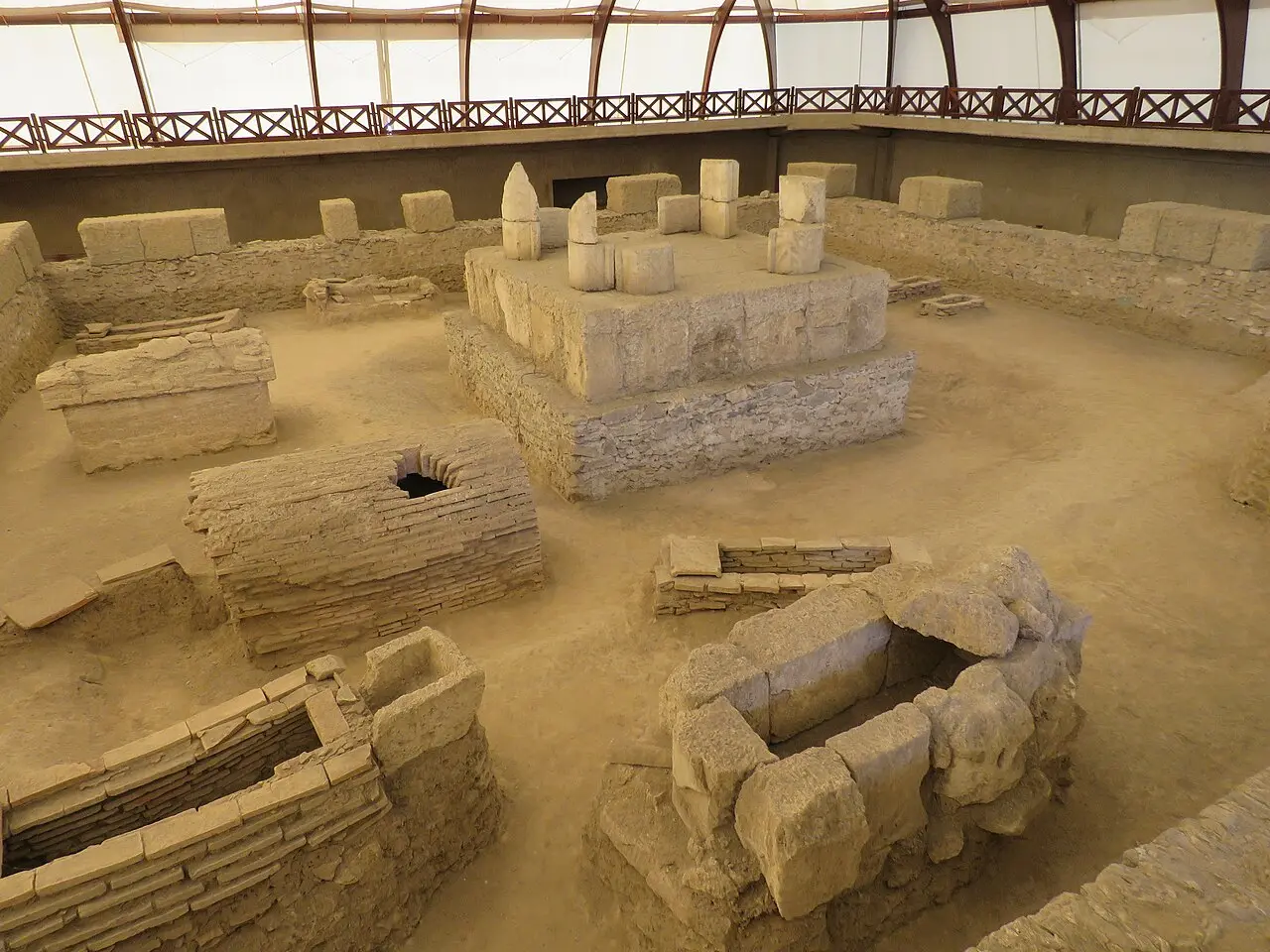
Two things catch people out here. First, you can only see the site on a guided tour, tours leave on the full hour, and the last one starts two hours before closing - in high season that means 17:00, with the gate open until 19:00. Turn up at 17:30 in July and you’ve made a 90 km drive for a locked gate. Second, the parts of the site sit far enough apart that you drive between them in your own car, following the guide. Tickets from the park’s own list: 1,050 RSD for the archaeological site, 1,400 RSD with the museum, under-10s free with a parent, guide included. One caveat for 2026: the mammoth park with Vika, the million-year-old skeleton dug from the mine in 2009, is closed for reconstruction, as is the Domus Scientiarum museum hall - check the park’s own site before you build a day around either.
Viminacium is also your first stop on the Roman Emperors Route, the 600 km trail linking the Serbian sites of the 17 Roman emperors born on today’s soil; you meet it again at Kladovo on day three.
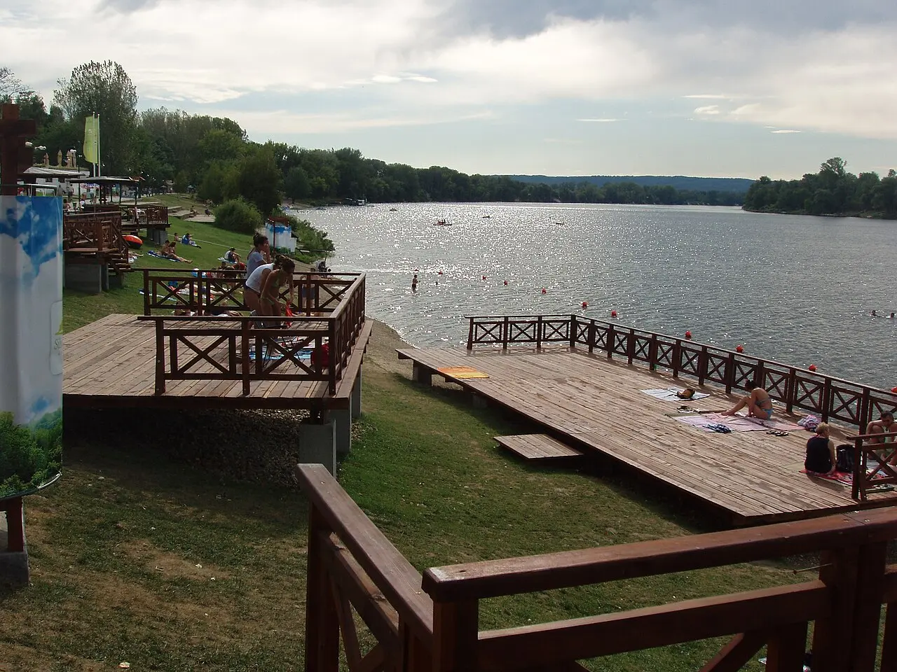
Finish the day at Silver Lake near Veliko Gradiste, about 110 km from Belgrade. It’s an old Danube meander sealed off by two dykes, roughly 14 km long and up to 13 metres deep, and it’s where half of eastern Serbia swims in August: sun decks, a marina, jet-skis, cycle paths along the shore. It’s not wilderness and doesn’t pretend to be. It’s the last dense cluster of beds and restaurants before the gorge, which makes it the sensible place to lose an evening.
Day 2: Golubac, the gorge road and Lepenski Vir
Golubac Fortress is 20 minutes from Silver Lake, which is the whole argument for sleeping there: be at the gate when it opens at 10:00 and you have the ramparts to yourself before the Belgrade coaches arrive at midday. The castle climbs a rock spur straight out of the water where the Danube - still six kilometres wide here - starts to funnel into the gorge, and the 2014-2019 restoration turned it from a roadside ruin into a proper visit.
Check the calendar first, because Golubac is closed on Mondays year-round. Hours track the season: 10:00-18:00 in July and August, 10:00-17:00 from May to June and in September, shorter either side. Tickets work in zones, but for most visitors only one is actually open. Zone I, the green zone, is 950 RSD and covers the palace and towers 9, 8 and 5 whenever the fortress is open. The upper zones are the catch: Zone III (red) is closed altogether, and Zones II and IV run only Friday to Sunday, 10:00 to 13:00 - the blue Zone II (1,600 RSD) an adults-only scramble without a guide, the black Zone IV (2,500 RSD) the full climb with a guide and safety gear for two people at a time. Turn up on a Tuesday expecting the top towers and you can’t: the green zone is all there is. Under-18s pay less or go free, parking and the visitor centre are included, and sales close 45 minutes before the fortress does.
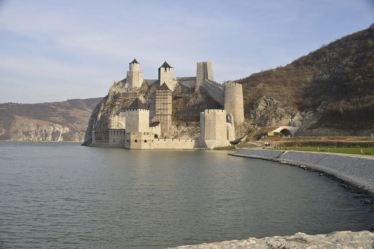
Look right as you leave for the mouth of the 152-metre tunnel that, since 2017, carries the road which for decades ran straight through the fortress gates, shaking the old walls apart - you’ll see why the bypass mattered. Our Iron Gate and Golubac guide goes deeper on the fortress and what the gorge holds beyond it.
From here the drive becomes the attraction: cut into the cliff, dipping through short tunnels, handing you the river at new angles. Use the laybys, allow two hours to Donji Milanovac even though the map promises less, and eat there, because the options thin out after it.
Lepenski Vir is 15 km beyond Donji Milanovac at Boljetin, signed off the main road and easy to drive past. People lived on this bend of the river across a long span from roughly 9500 to 5500 BC, rebuilding the same trapezoidal houses on the same footprints for generations, and around 6000 BC - some 8,000 years ago - they carved river boulders into round-eyed, fish-mouthed heads, among the oldest monumental sculpture anywhere in Europe. Those faces are the reason to stop - don’t drive past without at least a short visit. When the dam raised the Danube in the early 1970s the settlement was lifted about 30 metres uphill, and it now sits under a glass hall you look down into from a walkway.
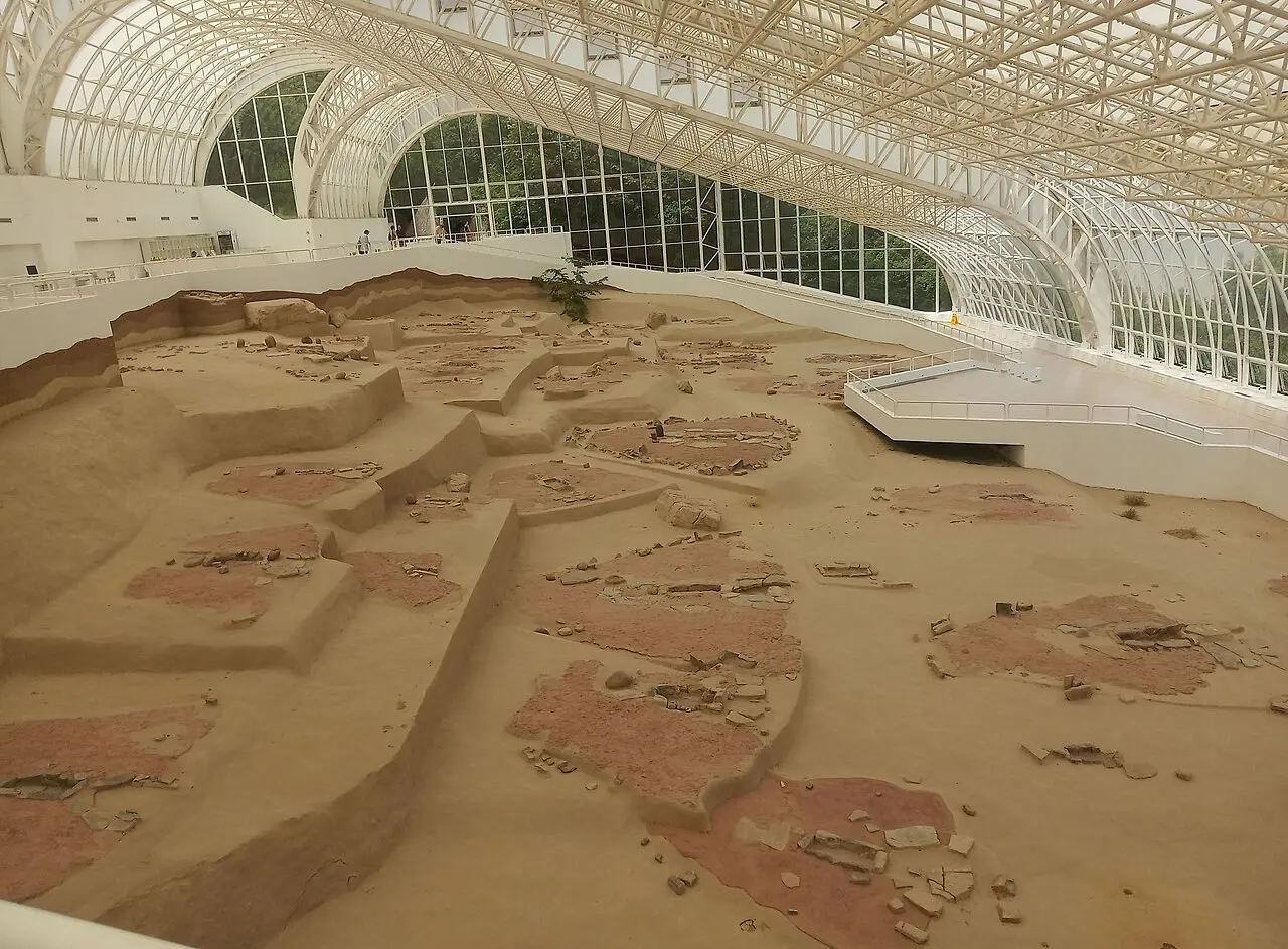
Hours follow the season, running late into the evening in high summer and shrinking to a few midday hours in winter, with reported tickets of around 500 RSD. It closes completely in February and publishes little detail online, so don’t drive a long detour to a locked door - phone ahead (+381 30 501 501) outside high summer. Then sleep in Donji Milanovac or push on to Kladovo; the second shortens day three.
Day 3: the Kazan narrows and the end of the gorge
The best view of the Danube in Serbia isn’t from the road. It’s from Ploce, a shelf of limestone 355 metres above the Mali Kazan narrows, and it asks for a small commitment: turn off the Danube road between the villages of Golubinje and Tekija, follow the forest track to the parking area, then walk 30-45 minutes through beech woods to the railings. The national park rates the full route from Pecka Bara at 3.5 km one way, medium difficulty, averaging about a 20% gradient. The track is unsurfaced and rutted after rain: a proper car can take the upper parking area for the short walk, but leave a low-slung hire car at the Pecka Bara lot lower down and do the full climb on foot. Entry to the park trails is collected at the info centre, so carry a little cash.
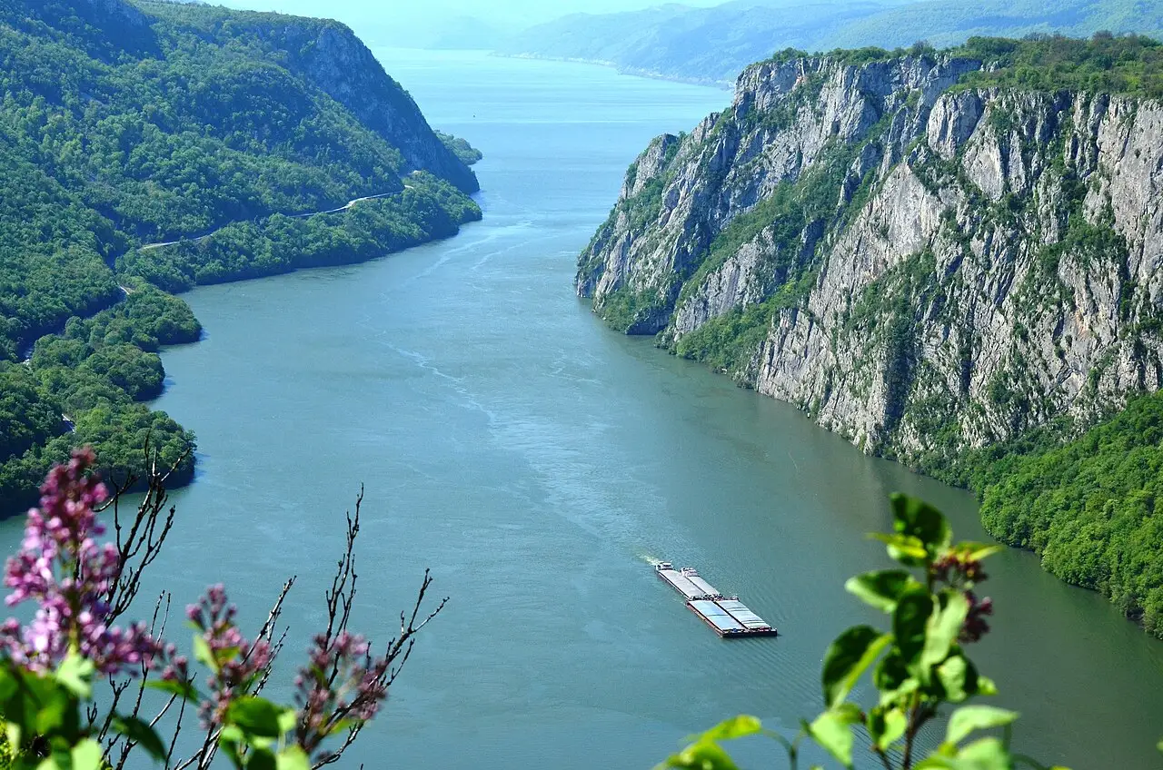
What you’re looking at is calmer than its reputation. The Iron Gate was a shipping nightmare for centuries - reefs, whirlpools, rapids that ate boats - until the dam went in between 1964 and 1972, a joint Yugoslav-Romanian project 60 metres high and 1,278 metres long. It drowned the rapids, raised the river dozens of metres, and took the inhabited island of Ada Kaleh with it. Its few hundred Turkish islanders, some families there for generations, were moved off before the water came - some to the mainland, many on to Turkey - and the island’s mosque and bazaar went under with the rock. The gorge you photograph today is technically a reservoir, which is why the barges slide through it so serenely.
Then Kladovo, 30 km on, where the cliffs let go and the Danube spreads out again. It’s a workaday border town rather than a resort, and it holds the last act of the Roman story. On the bank just downstream stands one pier of Trajan’s Bridge, built in 103-105 AD by Apollodorus of Damascus to carry the legions into Dacia: 1,135 metres long on twenty masonry piers, probably the longest arch bridge anywhere for the next thousand years, even though Hadrian had the timber roadway taken down only a couple of decades after it opened. Only the two entrance pillars survive above water, one here and one across the river at Drobeta-Turnu Severin. Nearby sit the excavated Roman fort of Diana and the 16th-century Ottoman fortress of Fetislam, the “Gate of Islam” - both open-air sites you can reach in any daylight hour rather than ticketed museums, which makes Kladovo an easy soft landing at the end of the drive.
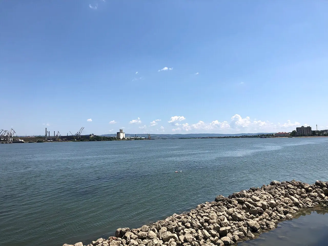
From Kladovo it’s roughly 250 km and three and a half hours back to Belgrade, retracing the gorge or cutting inland via Negotin and Zajecar. With a fourth day, don’t retrace: our Timok Valley wine and Rome loop picks up almost here and runs to Felix Romuliana and the wine cellars of Rajac, while the eastern Serbia wonders loop sweeps up Manasija, Resava Cave and the Krupaj spring on the way home.
Where to sleep, and how to split the nights
- Silver Lake, then Kladovo - the version above. Balanced driving, a swim on night one, and you finish at the far end of the gorge, free to continue east instead of doubling back.
- Silver Lake, then Donji Milanovac - better if you want the Kazan viewpoint early on day three and dinner a short walk away. Donji Milanovac is small, so beds go early in August.
- Two nights in Donji Milanovac - the lazy option, at the cost of driving the gorge road four times instead of two.
Book ahead for July and August: this is Serbia’s own holiday coast, and the good rooms go weeks in advance.
Practical notes before you set off
- Timing beats distance. Assume about 50 km/h east of Golubac and you’ll not be disappointed.
- Watch the closing days. Golubac shuts on Mondays and Viminacium’s last tour leaves two hours before the gate - two avoidable ways to gut the trip.
- Carry cash in dinars. Cards work at the big fortresses, but the smaller museums, the park kiosks and the village restaurants prefer notes.
- Fuel up around Veliko Gradiste. Stations east of it are sparse and some keep short hours.
- Season. May to October, September best: warm water, thin crowds, long days. In winter Lepenski Vir cuts its hours and the gorge road gets slick.
- If you only have one day, see the best day trips from Belgrade. Golubac is the sensible target, and everything past it really does need the overnight. Prefer a guided boat day from the capital instead of the self-drive? Prices and operators for Belgrade city boats and Iron Gate packages are on Danube river cruises in Serbia.
The Serbian Danube rewards patience more than mileage: a Roman capital nobody outside the country talks about, an 8,000-year-old fishing village with a face carved in stone, and a river that shoulders two mountain ranges apart. Browse more drives in the routes section, or fold this leg into the longer 10-day Serbia road trip.
Route day by day
- Days on the road
- 3
- Distance
- ≈300 km
- Budget from
- 190 EUR
- Best season
- May, June, July, August, September, October
The route at a glance
-
Belgrade
Route startstop ≈0 min
Start point. Collect the car and take the A1/E75 motorway south, then turn off east for Smederevo. Fill up before you leave the city - stations thin out past Veliko Gradiste.
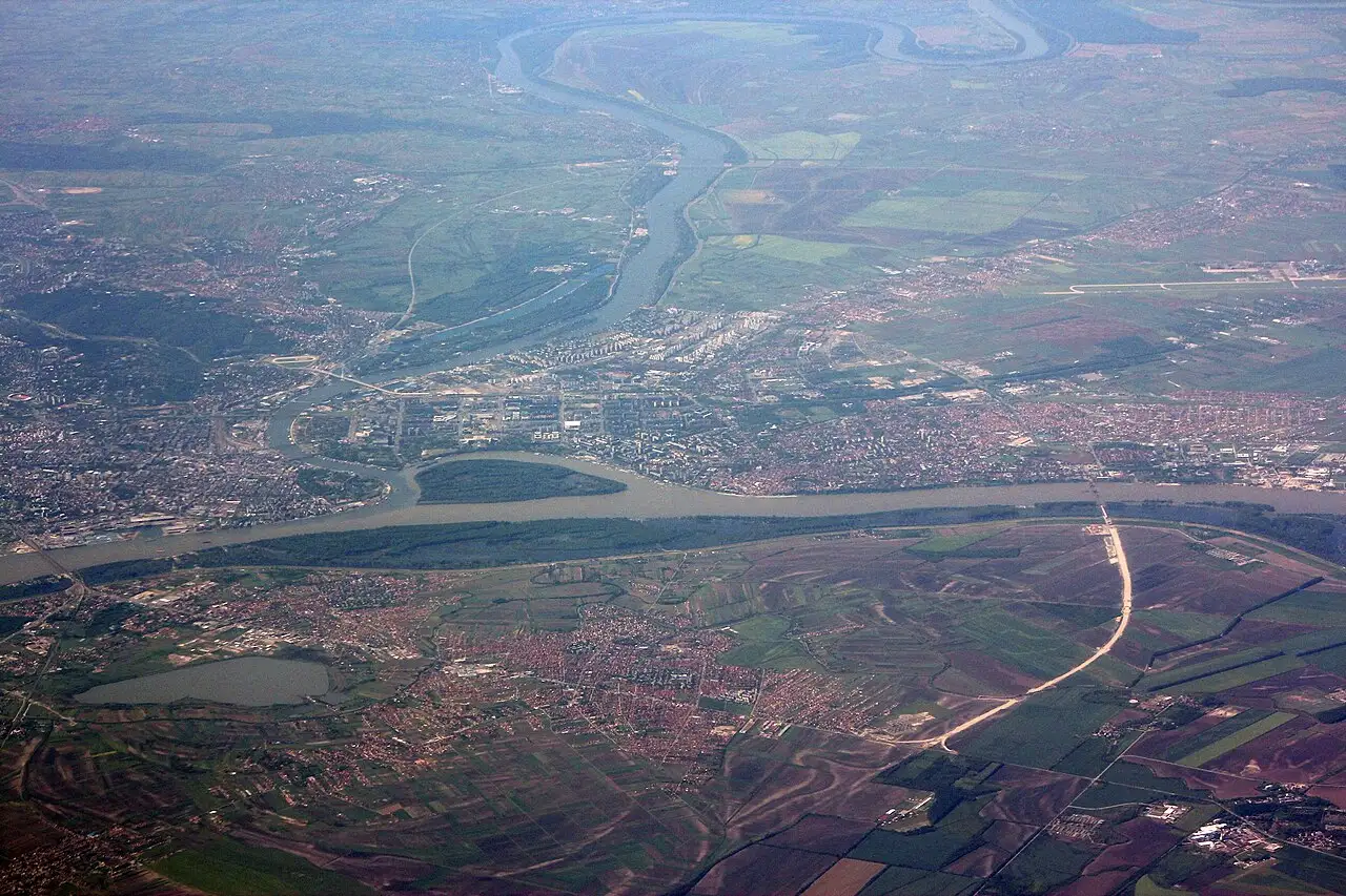
Photo: Marek Slusarczyk (Tupungato) / Wikimedia Commons, CC BY 3.0 ( source) -
Smederevo Fortress
50 km from the startstop ≈75 min
The 1427-1430 capital of the Serbian Despotate: 11.3 hectares, about 25 towers, walls straight into the Danube. Ticketed inner court (Mali grad), free outer grounds.
Photo: Dekanski / Wikimedia Commons, CC BY-SA 4.0 ( source) -
Viminacium
90 km from the startstop ≈120 min
Roman capital of Moesia Superior near Kostolac: imperial mausoleum, thermae, amphitheatre. Guided tours only, on the full hour; the last one starts two hours before closing.
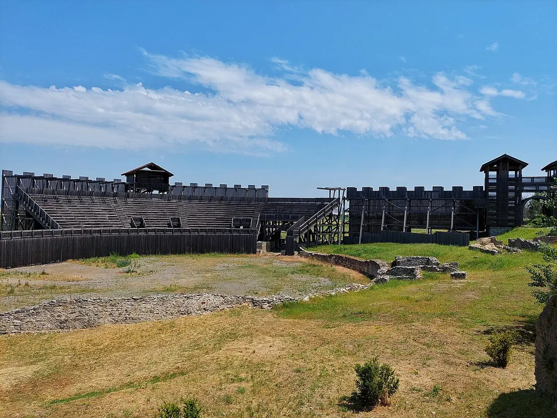
Photo: Karolina Djukic / Wikimedia Commons, CC BY-SA 4.0 ( source) -
Silver Lake (Srebrno jezero)
130 km from the startstop ≈720 min
Night one. An old Danube meander closed off by two dykes, about 14 km long - swimming, a marina and the densest cluster of beds before the gorge.
Photo: Ant83 at Serbian Wikipedia / Wikimedia Commons, Public domain ( source) -
Golubac Fortress
150 km from the startstop ≈150 min
The castle at the mouth of the gorge, restored 2014-2019. Closed Mondays; ticket sales stop 45 minutes before closing for the basic zone.
Photo: Miomir Magdevski / Wikimedia Commons, CC BY-SA 4.0 ( source) -
Lepenski Vir
230 km from the startstop ≈90 min
Mesolithic village on the river at Boljetin, lifted 30 m uphill when the dam raised the Danube. The fish-mouthed sandstone heads are the reason to stop.
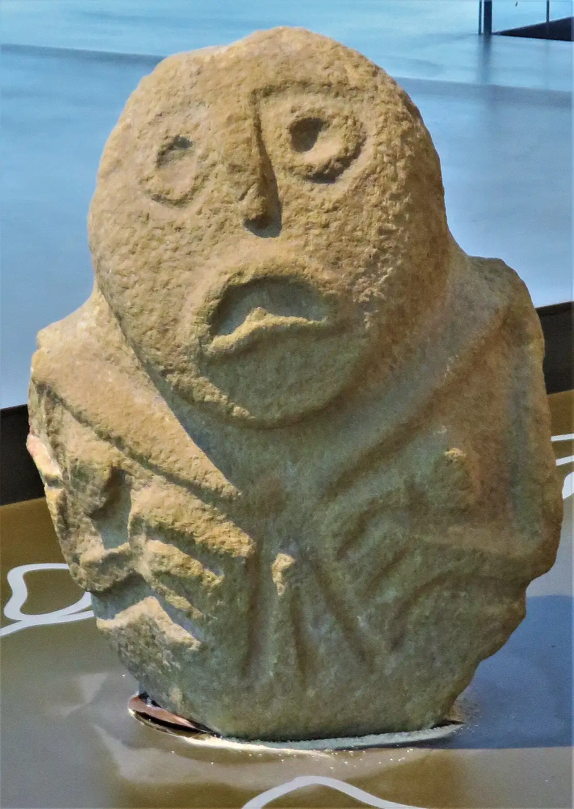
Photo: Beko / Wikimedia Commons, CC BY-SA 4.0 ( source) -
Ploce viewpoint, Mali Kazan
270 km from the startstop ≈150 min
Turn off the Danube road between Golubinje and Tekija, then a forest track and 30-45 minutes on foot to railings 355 m above the narrows.
Photo: Dragalena / Wikimedia Commons, CC BY-SA 4.0 ( source) -
Kladovo
300 km from the startstop ≈240 min
End of the gorge: the Ottoman Fetislam fort, the Roman fort of Diana, the surviving pier of Trajan bridge and the Iron Gate dam. Beds, restaurants and the drive home.
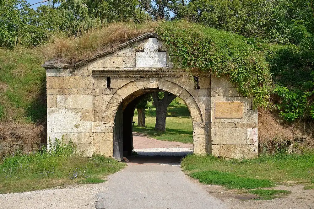
Photo: Pudelek / Wikimedia Commons, CC BY-SA 4.0 ( source)
Route map
The map with stops loads on click - to keep the page lightweight.
The map didn’t load. Check your connection and refresh the page.