Best Hiking in Serbia: Trails & Peaks
Where to hike in Serbia by difficulty and season: Tara, Stara Planina, Kopaonik, Uvac, Fruška Gora and Zlatibor, with the gear and timing you need.
Serbia is a better hiking country than its reputation suggests, and the range is the point: you can stand on a 2,000-metre border summit, walk to a viewpoint over one of Europe’s most photographed river canyons, or amble through monastery woods an hour from a city, all within one country. This guide sorts the best of it by how hard the walking is and when to go, so you can match a mountain to your legs and your dates rather than driving four hours to the wrong one.
A word on how Serbia’s hills actually work. The big peaks sit in the west, south and far south-east, most of them a long way from Belgrade and almost all easier with a car, since trailheads tend to be up dead-end valleys with thin bus service. The gentle stuff, the forest and canyon walks, clusters nearer the northern cities. Below, each area gets its own angle and, where we have a full guide to it already, a link so you can go deep on logistics without wading through it all here.
Easy: forest, plateau and canyon walks
If you want scenery without a summit push, start in the north. Fruška Gora, the low green ridge right beside Novi Sad, is the softest introduction to hiking in the country: Serbia’s first national park, declared back in 1960, laced with hundreds of kilometres of marked forest paths through oak and lime, and topping out at a gentle 539 metres. Nothing here is steep, the woods are shady in summer, and you can string a walk between centuries-old monasteries and a vineyard lunch. The annual Fruškogorski maraton shows how walkable the network is. For the monastery-and-wine logistics that pair with the trails, see our full guide to Fruška Gora National Park.
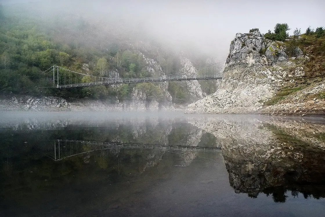
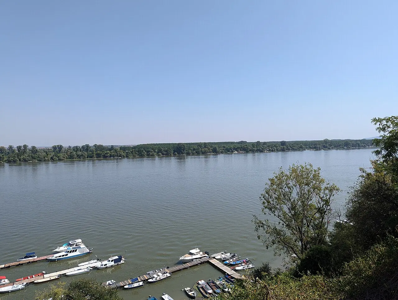
Two more easy-but-spectacular walks belong here. At Tara National Park in the west, the headline is the short stroll out to the Banjska Stena viewpoint, a railed ledge at 1,065 metres that drops straight down onto Lake Perućac and the Drina canyon. The walking is minimal; the drama is all in the view. Down in Zlatibor, the high pine plateau is made for gentle rambling: flat meadow paths near the resort, easy loops for families, and the option to ride the long gondola up toward the high ground rather than climb it. Zlatibor also makes the smartest base for the whole western cluster, which our Zlatibor guide lays out.
The Uvac meanders: the walk everyone photographs
One easy walk deserves its own billing, because it delivers the single most striking view in Serbia for very little effort. The Uvac canyon in the south-west is famous for its meanders, where the river doubles back on itself in tight green loops between pale limestone walls. You see them best from above, at the Molitva and Veliki vrh lookouts, and reaching Molitva is a walk of roughly 7 kilometres, about 45 minutes each way from the lakeside, on a trail most reasonably fit people manage without trouble. Many visitors combine it with a boat trip on the reservoir and the ice cave.
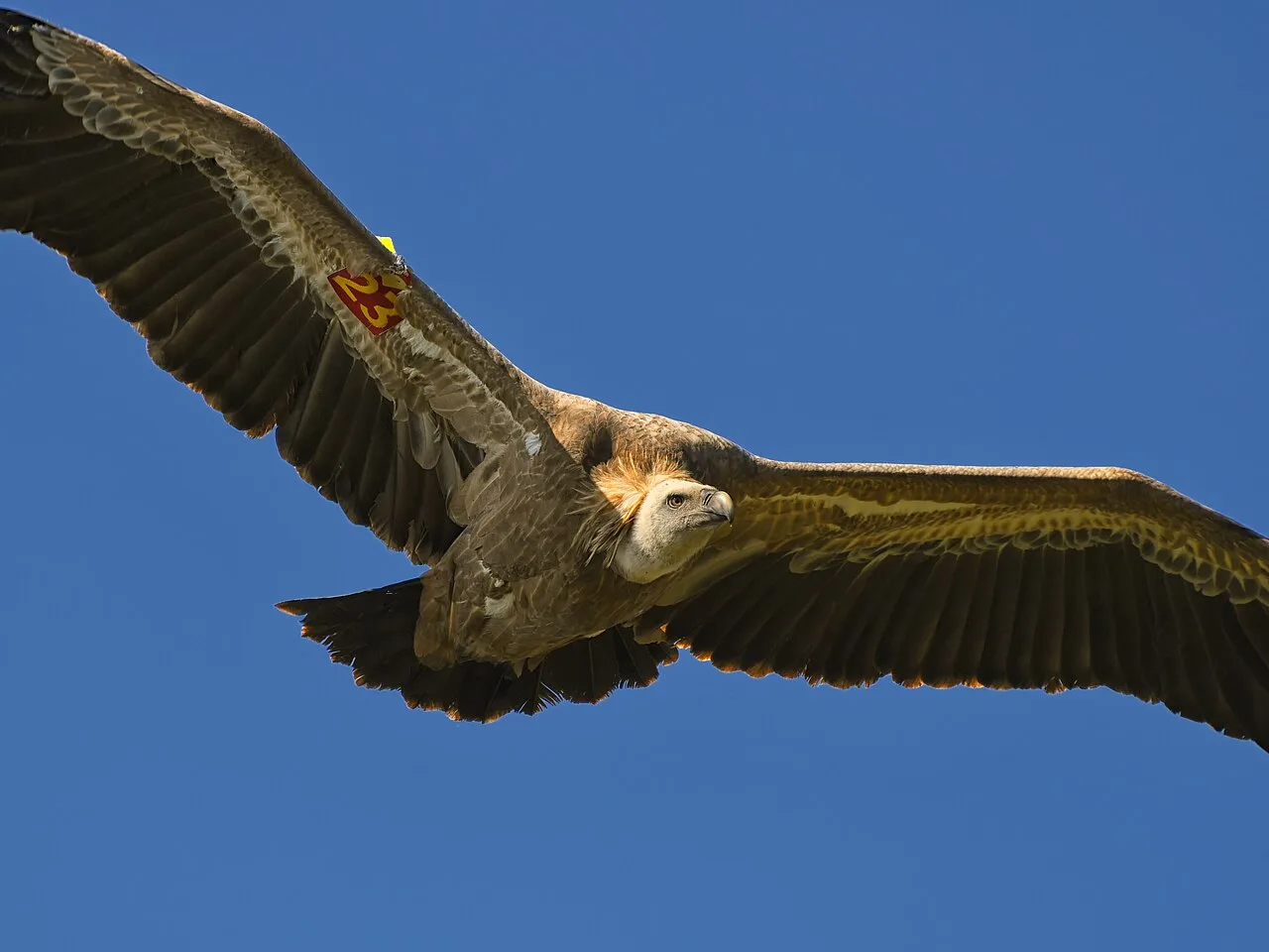
What sets Uvac apart is what shares the sky with you. The reserve is a stronghold of the griffon vulture, Serbia’s largest bird, with a wingspan close to three metres, and on a good day you will watch several ride the thermals over the canyon while you eat your sandwich. Bring binoculars and a hat: the viewpoints are exposed, and in high summer the walk up gets hot with no shade, so go early or late in the day.
Serious: the high peaks
When you want a summit under your boots, Serbia has three that reward the effort. The highest is Midžor, at roughly 2,169 metres the top of mainland Serbia, sitting right on the Bulgarian border on the wild Stara Planina range. It is a long walk rather than a technical climb: the usual line from the Babin Zub area runs around 7.4 kilometres to the top over open, rolling grassland, gaining about 600 metres, so the challenge is stamina and weather, not scrambling. One thing to know, since you will see the claim made both ways: Midžor is the high point of Serbia proper, but if Kosovo is counted the country’s tallest is Velika Rudoka in the Šar mountains, well over 2,600 metres. Stara Planina is also the emptiest corner of the country, which is half its appeal, and our Stara Planina guide covers the waterfalls and remote villages you can fold into the trip.
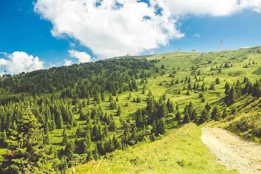
Kopaonik is the friendliest of the big three. Its summit, Pančićev vrh at 2,017 metres, sits on a broad plateau in the national park, and in summer a chairlift runs up toward the top, which turns a serious peak into a family day out: ride most of the height, then walk the last stretch, taking in the Nebeske Stolice archaeological site just below the summit at around 1,800 metres. Off the lift, the plateau opens into gentle meadow trails through pine and alpine flowers, so Kopaonik works whether you want a proper walk or a soft one.
The third summit is Tornik, at 1,496 metres the high point of Zlatibor, reachable via the long panoramic gondola from the resort followed by a modest walk. It is the least demanding of the three peaks and the easiest to reach, which makes it a good first summit if you are easing into mountain walking.
Between the two: Čigota and the Drina country
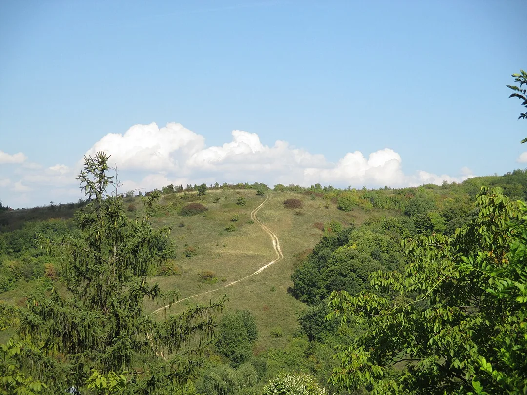
Not everything falls neatly into easy or serious. Zlatibor’s Čigota trail is the middle ground: a popular route of about 11.2 kilometres, roughly three hours, with real climbing and panoramic payoff, best for anyone reasonably fit who wants more than a meadow stroll but less than a 2,000-metre border peak.
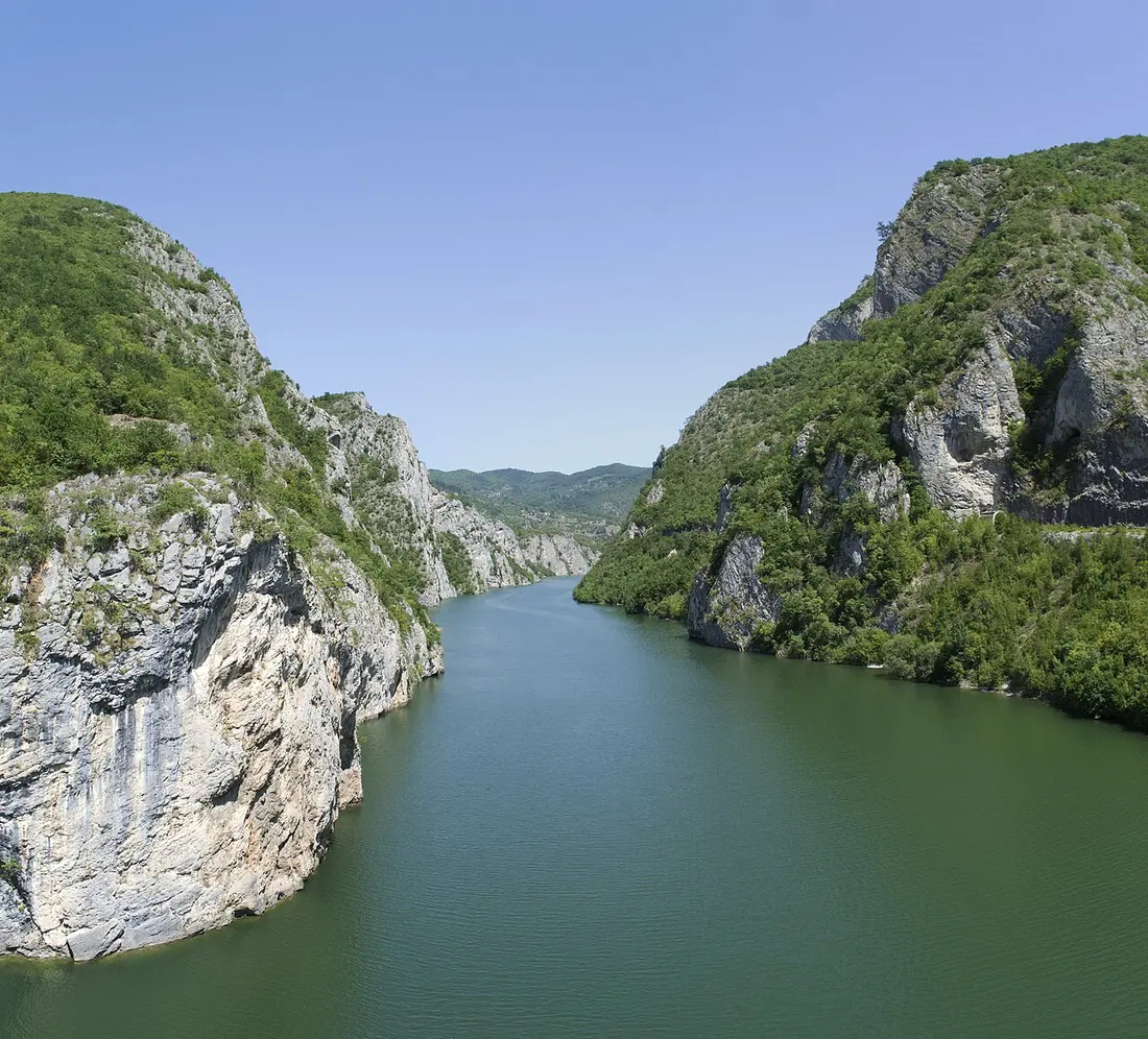
The Đerdap area in the east offers a different flavour of walking again: forest trails and viewpoints along the Iron Gate, the vast Danube gorge, with the restored Golubac Fortress at its mouth. This is river-and-woodland hiking rather than peak-bagging, and it pairs a walk with big water and history in a way nowhere else in Serbia does. If it appeals, our Iron Gate and Golubac guide has the practical detail.
When to go, and what to bring
Season decides more than trail choice here. The high peaks, Midžor, Pančićev vrh and Čigota, are broadly at their best from late June to early October, once the snow has cleared the tops; snow can linger high into spring, and summer afternoons brew thunderstorms, so start early and be off the exposed ground by mid-afternoon. The lower walks, Fruška Gora, Uvac and the Drina viewpoints, open up earlier and stay good later, roughly April through October, though the exposed Uvac lookouts bake in July and August. Always check the local forecast and conditions before you set out; mountain weather here turns fast.
Pack for real mountains even on the “easy” days. Proper boots with grip, layers for a wind that bites at altitude, more water than you think you need, and sun protection for the treeless plateaus. Phone signal drops out in the dead-end valleys of Stara Planina and around Uvac, so carry an offline map and tell someone your plan. The forests of Tara and Stara Planina are brown-bear country: encounters are rare and the bears want nothing to do with you, but make a bit of noise on quiet forest trails and do not leave food lying around.
Two logistics that pay off. First, hire a car for anything outside Fruška Gora, because the western and southern trailheads sit well off the bus routes and a vehicle turns a stressful day into an easy one. Second, sort travel insurance that actually covers hiking and mountain rescue before you go, since a twisted ankle two hours up a remote ridge is not where you want to discover a gap in your policy.
Match the mountain to your appetite and your calendar, get the car and the cover sorted, and Serbia turns into one of the more surprising walking destinations in this part of Europe: high, wild and largely to yourself.
Photos
Read also
Belgrade Stag & Bachelor Party Guide
Verified · July 4, 2026Planning a Belgrade stag or bachelor party: where to base the group, rafting and karting by day, the nightlife, transfers and the scams to dodge.
Belgrade Nightlife: Splavovi, Clubs & Bars
Verified · July 3, 2026How to go out in Belgrade: the splav river clubs, the Cetinjska bar yard, Savamala, Skadarlija, techno vs turbo-folk - plus the scams to dodge.
Belgrade Neighbourhoods: A Local Guide
Verified · July 4, 2026What Belgrade's districts are really like: Stari Grad, Dorćol, Savamala, Vračar, Zemun, Novi Beograd and Skadarlija, and the character of each.
Belgrade to Niš: How to Get There
Verified · July 4, 2026Belgrade to Niš is a bus job, not a train one: about 3 hours by coach vs 6 by rail, plus the drive, prices and why the fast line does not run south yet.