Kopaonik: Serbia's Top Ski & Spa Resort
Kopaonik is Serbia's biggest ski resort and a national park: the pistes and lifts, the 2,017 m Pančić peak, summer hiking, spas and how to get there.
Kopaonik is Serbia’s mountain for snow. It is the country’s biggest and highest ski resort, sitting on a broad plateau in southern Serbia with its base already above a thousand metres and its top station on the 2,017-metre Pančić peak, and in winter it draws most of the country’s skiers to about 55 kilometres of pistes. But it is not only a ski station: the whole range is a national park, one of the richest patches of nature in the Balkans, so in summer the same slopes turn into gentle hiking and biking country, and a scatter of thermal spas sits within easy reach for the days you want to do nothing at all. This guide covers what Kopaonik actually offers in each season, and how to get to a resort that is further from Belgrade than it looks on the map.
If you are choosing between Serbia’s mountains, the short version is this: come to Kopaonik if skiing or high-mountain scenery is the point, and to gentler, lower Zlatibor if you want an easy spa-and-walking break closer to the capital. They are different kinds of holiday, and the rest of this page is about what makes Kopaonik its own thing.
Where is Kopaonik, and what is it?
Kopaonik is a long mountain range straddling the border of southern Serbia, its highest ground gathered around the Ravni Kopaonik plateau (also called Suvo Rudište) at roughly 1,700 metres. That high, flat base is the single fact that shapes everything here: the resort village, the hotels and the bottom of the lifts all sit up on the plateau rather than down in a valley, which is why the skiing is snow-sure by Serbian standards and why the summer air stays cool.
The name tells you the mountain’s older story. Kopaonik comes from the Serbian kopati, “to dig”, because for centuries this was mining country. In the Middle Ages it was the main mining region of the Serbian state, worked for silver, lead and iron, and it was once known as the “Silver Mountain”. The pits are long closed, but the name stuck.
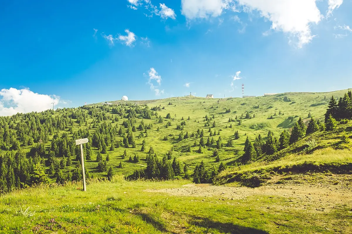
Above the old mines, the mountain is now protected as Kopaonik National Park, established in 1981 and covering about 120 square kilometres. It is a genuine biodiversity hotspot: something like 1,600 plant species grow here, of which roughly 200 are found nowhere else on Kopaonik’s scale, a concentration of endemic highland plants that puts the range among the most important in the Balkans. That protected status is the backdrop to everything you do here, on skis or on foot.
Skiing: Serbia’s biggest and highest resort
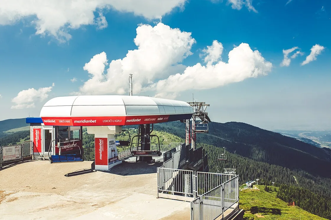
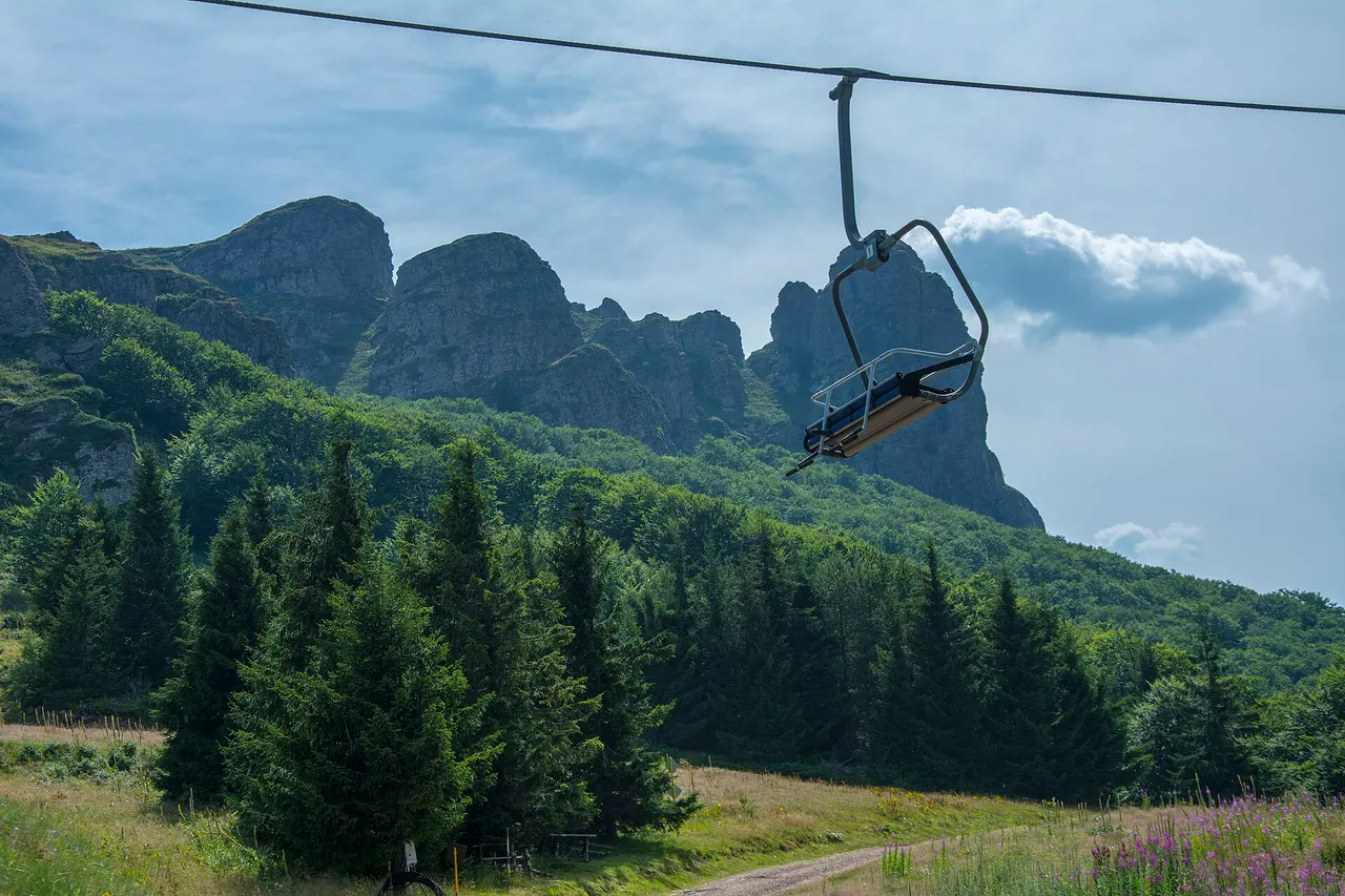
For most visitors, Kopaonik means winter. It is comfortably the largest ski area in the country, with around 55 kilometres of marked alpine pistes served by roughly 26 lifts, plus cross-country trails on the plateau. The runs are spread across a friendly range of difficulty: a bit more than half are easy blue slopes, about a third are intermediate reds, and only a small share are genuinely difficult black runs. That mix is why Kopaonik has a reputation as a good place to learn or to ski as a family, rather than a resort built for experts.
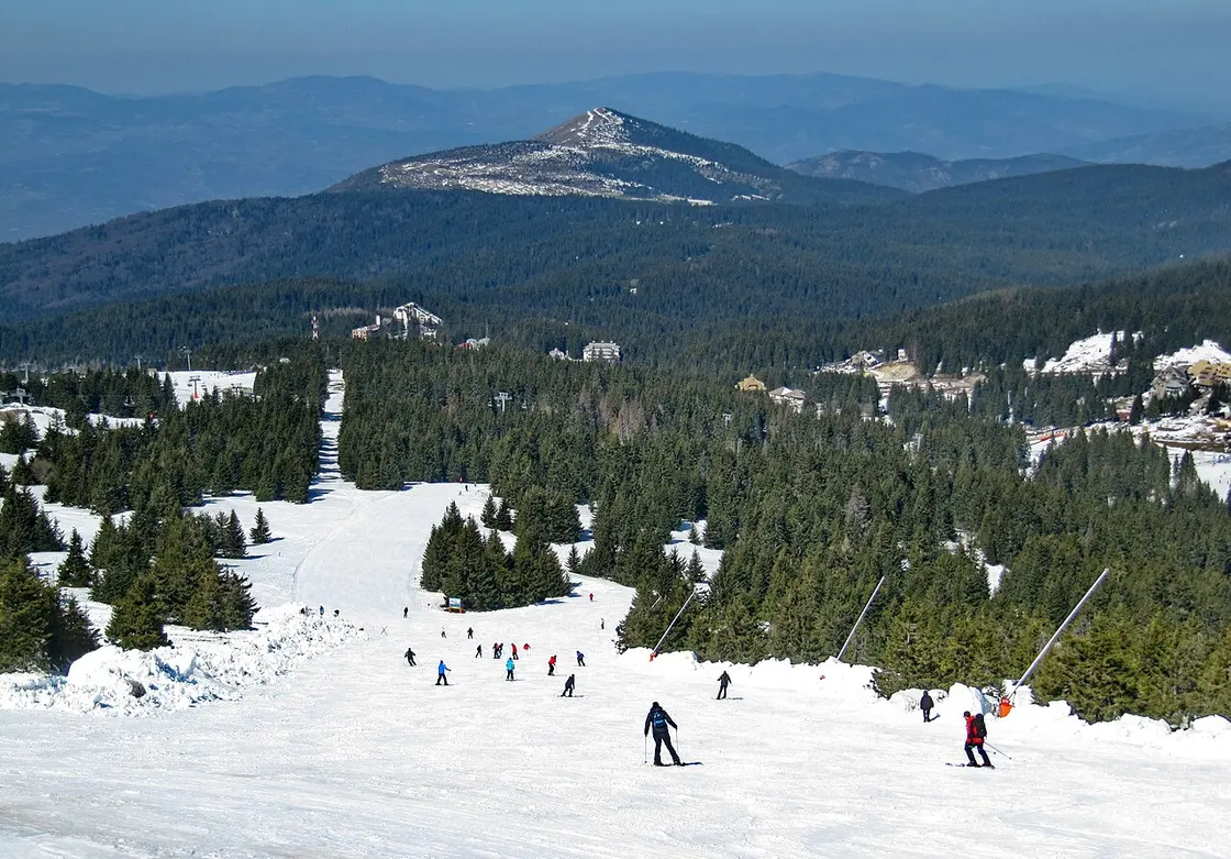
The vertical is modest but real: the lifts run from a base around 1,060 metres up to the 2,017-metre top, a drop of just under a thousand metres. The season normally runs from early December to early April, and Kopaonik has a useful trump card here, the reason locals call it the “sunny mountain”: it averages around 200 sunny days a year, so you get a lot of bright, blue-sky skiing rather than the grey murk that dogs some ranges. Snow is helped along by snowmaking on the main runs, but this is still a southern European mountain, so it pays to check current conditions before booking a ski week around fixed dates.
One thing I will not do is print a lift-pass price, because ski passes here are seasonal and change year to year, and any figure I quote would mislead you by the time you read it. Check the current day and multi-day pass rates with the resort before you go.
The Pančić peak and the summit
The high point of the mountain, and of the ski area, is Pančić’s Peak (Pančićev vrh) at 2,017 metres. It is named after Josif Pančić, the nineteenth-century botanist who catalogued Serbia’s flora and famously identified the Serbian spruce (Picea omorika), a rare relict conifer. Pančić asked to be buried on the mountain he loved, and a small stone mausoleum stands on the summit holding his remains. It is an unusual thing to find at the top of a ski lift, and it gives the peak a quiet significance beyond the panorama.
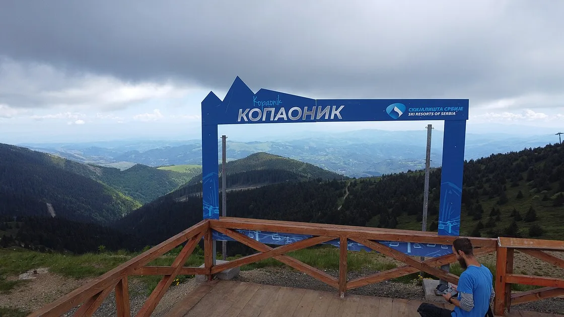
From the top, on a clear day, the view runs a long way across southern Serbia and toward the mountains of the Kosovo border. In winter you reach it on skis or by lift; in summer you can walk up from the plateau in a gentle hour or two, which is one of the mountain’s most popular easy hikes.
Summer on Kopaonik: hiking, biking and the national park
Kopaonik has quietly become a year-round mountain, and summer is the season people underrate. Once the snow goes, the plateau turns into green, rolling walking country: marked hiking trails thread across the meadows and through the spruce forest, the lifts keep running to carry you up for the views, and the cool altitude is a genuine relief when Belgrade is baking in July. Cyclists have it good too, with the plateau and the forest roads opening up a network of mountain-biking routes.
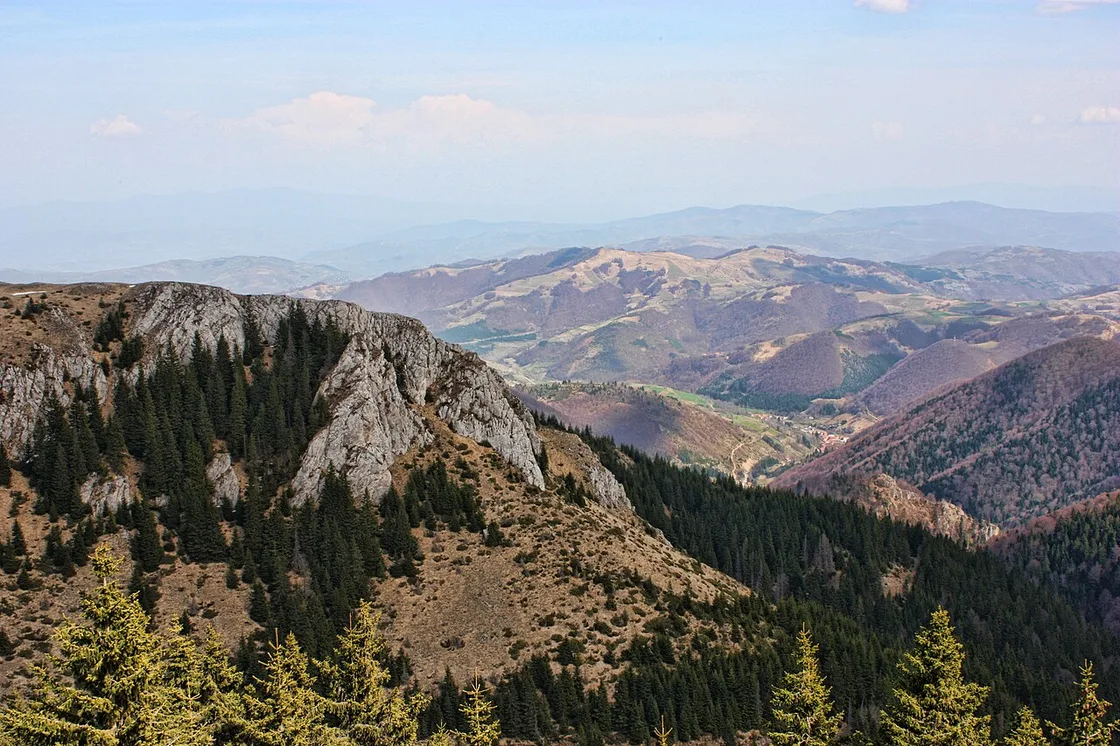
The national park is the draw. The signature natural sights are the rocky outcrops and viewpoints scattered across the range and, for walkers willing to go further, the Jelovarnik waterfall, which at around seventy metres is the third-highest in Serbia, tucked into forest on the mountain’s eastern side. Because so much of the range is protected, the summer feels wild in a way the groomed winter slopes do not, and the wildflower meadows in June and July are a large part of why botanists still make the trip that Pančić did.
Spas near Kopaonik
Part of the region’s appeal is that you can pair the mountain with a soak. Kopaonik sits among some of Serbia’s thermal spa towns (banje), and two are worth knowing. On the western flank of the mountain, in the Raška valley, lies Jošanička Banja, a small spa whose hot mineral springs have been used since the nineteenth century - their healing properties were formally examined back in 1834, at the request of Prince Miloš. Further round, above the Kuršumlija side, is Lukovska Banja, which at around 680 metres claims the title of the highest spa in Serbia, with a cluster of thermal pools and wellness hotels.
Neither is on the plateau itself, so treat them as a separate leg of a trip rather than a stroll from your ski hotel; you will want a car to combine the mountain with a spa comfortably. And a note of common sense: spa waters are marketed for all sorts of complaints, but take any health claim with a doctor rather than a brochure. As a place to ease tired legs after a day on the slopes or the trails, though, they are a lovely add-on.
How to get to Kopaonik
This is the part that catches people out. Kopaonik feels close on a map, but it sits in a remote corner of southern Serbia, and there is no train to the resort. Realistically you have two options. Driving is the most flexible: it is roughly 250 to 290 kilometres from Belgrade depending on the route you take, and about three to three and a half hours on the road, climbing steeply up to the plateau at the end. A car also makes the spas and the wider region reachable, which a coach never will.
The alternative is the bus. There is a daily long-distance coach from Belgrade toward Kopaonik, but it is a slow haul - reckon on the best part of a day rather than a quick hop, and check the current timetable, because departures are limited and change with the season. For the general lie of the land, our guide to getting around Serbia explains why a car is close to essential once you leave the Belgrade-Novi Sad corridor, and Kopaonik is a textbook case: reaching the resort and everything around it is far easier on your own wheels.
Once you are up there, the resort village is compact and walkable, and in winter you ski or lift between the slopes. For the wider question of when the snow is good and when the summer trails are at their best, see our guide to the best time to visit Serbia, which lays out the ski season against the rest of the country’s calendar.
Really there are two Kopaoniks, and the one you meet depends entirely on the month. Turn up in February for Serbia’s longest, most reliable ski runs; turn up in July for wildflower meadows, cool forest air and a thermal spa an hour down the valley. Both are worth the long drive south, as long as you know which mountain you booked for. For a gentler peak closer to Belgrade, Zlatibor is the natural alternative; for the full sweep of Serbia’s peaks and landscapes, browse the attractions section.
Photos
On the map
The map loads on click - to keep the page lightweight.
The map didn’t load. Check your connection and refresh the page.
Distance≈270 km · ~3-3.5 h by car
- Belgrade≈270 km · ~3-3.5 h by carRoughly 260-290 km depending on the route; a long daily bus also runs, but there is no train to the resort.
Read also
Best Day Trips from Belgrade
Verified · July 4, 2026The best day trips from Belgrade, sorted by real travel time: which are a true there-and-back day, which need an overnight, and how to reach each.
Đavolja Varoš: Serbia's Devil's Town
Verified · July 4, 2026Serbia's Devil's Town (Đavolja Varoš): 200-odd andesite-capped earth pyramids and two acid springs on Radan Mountain, plus tickets, hours and how to visit.
Petrovaradin Fortress: Novi Sad's Gibraltar
Verified · July 4, 2026A deep dive into Petrovaradin Fortress: the star-fort design, the 1716 battle, 16 km of underground galleries and the artists who live on the ramparts.
Stara Planina: Serbia's Wild Eastern Mountains
Verified · July 4, 2026Stara Planina, the wild Balkan range on the Bulgarian border: Midžor peak, the Tupavica and Pilj waterfalls, the stone village of Gostuša and Babin Zub.